
When I think about Route 66, I think about movement: traveling wide-open desert, through small towns, past roadside stops, and seeing places that create a historic travel experience. The Mother Road is more than pavement. It is a corridor comprised of signs, bridges, diners, motels, gas stations, and road segments that still carry the feel of American travel in the early automobile age.
I have had the chance to work on Route 66 projects across several states with Mead & Hunt, and that work has helped me experience the details that make the road historic. Now, when I travel it, I see layers of history, design, engineering, and stories in these resources that keep the Mother Road’s allure alive—so motorists can continue to get their kicks on Route 66.
California Dreamin’
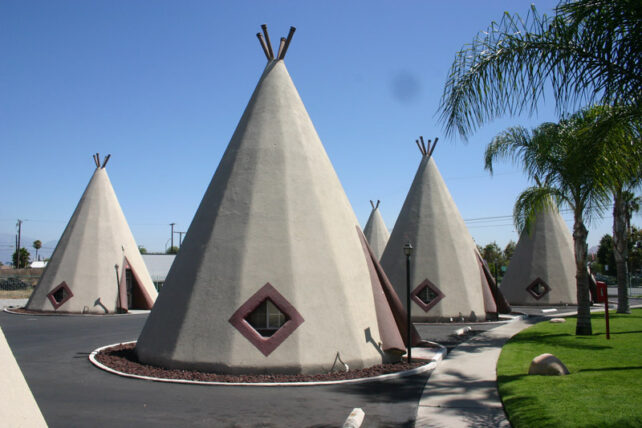
Starting in California, a must-see gem is the iconic Wigwam Village #7 in San Bernardino. The teepee-shaped motel units are playful, strange, and unforgettable—exactly the kind of place that reminds me that Route 66 is a full-fledged experience.
Our work in California included extensive research and documentation tied to a Multiple Property Documentation Form for the state’s Route 66 resources. That meant looking closely at the road, bridges, motels, signs, service stations, and recreational sites that together tell the story of travel in California. Places like Wigwam Village stand out because they show how architecture itself became part of the attraction. As part of our work in California, we completed a nomination for Wigwam Village #7 and it is listed in the National Register of Historic Places.
Take It Easy
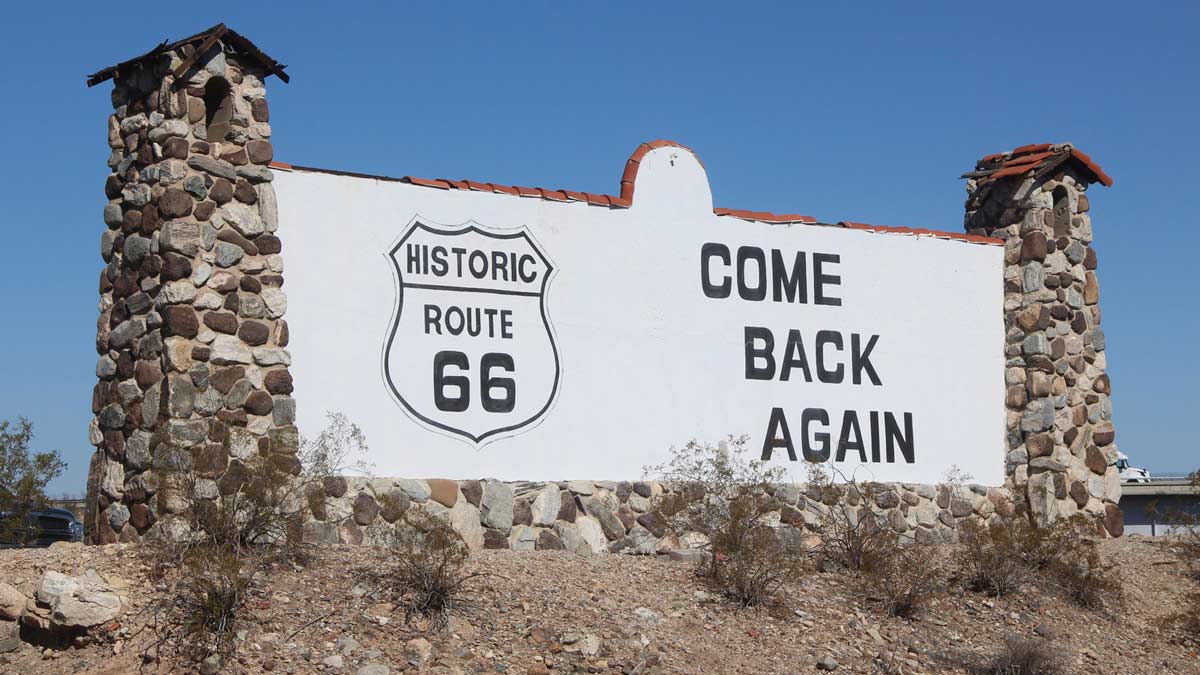
Near the California-Arizona line, the landscape opens into the Mojave Desert, and you’ll spot the Route 66 Welcome Sign, a landmark that announces arrival to and from, now serving as a classic historic roadside billboard that greets travelers. The Welcome Sign shows how preservation can renew a familiar landmark without losing its history. Mead & Hunt completed a historic structure assessment, researched its stonework and paint history, and helped guide rehabilitation using the Secretary of the Interior’s Standards for Rehabilitation. For me, it is a reminder that even something as simple as a roadside sign can carry the history of travel, identity, and arrival.
Standing near the Welcome Sign, I could look east toward the Old Trails Bridge over the Colorado River and imagine what that crossing must have meant to earlier travelers. This is where John Steinbeck’s Joad family finally reached California in “The Grapes of Wrath”—here I felt the sense of desperation and hope Dust Bowl migrants must have felt as they traveled the road west looking for a new beginning.
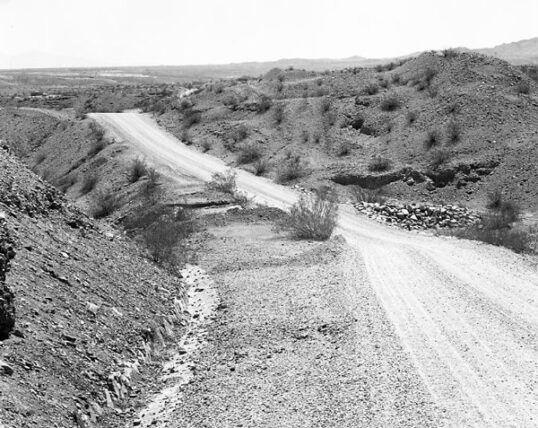
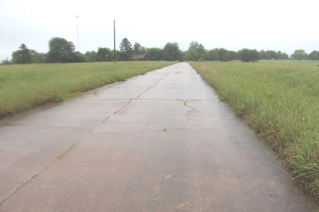
Nearby, the road itself becomes the focus. In this area, I was involved in documenting early Route 66 roadbed segments for the Historic American Engineering Record for inclusion into the Library of Congress. Comprised of engineered curves, drainage features, and several surviving alignments, it shows how much design and labor went into making desert travel possible in the late 1920s and into the 1930s. This part of Route 66 reminds me that sometimes the story of how the road was engineered and its construction has its own chapter hidden within the bigger story.
I’ve Been Everywhere
Traveling farther east, Route 66 crosses a wide range of roadside buildings in Missouri, Kansas, and New Mexico. In those states, Mead & Hunt surveyed more than 1,000 properties for the National Park Service, revisiting previously documented resources and identifying candidates for recognition. What stays with me is the variety of resources: motor courts, diners, gas stations, bridges, abandoned road segments, tourist cabins, and signs. Route 66 history is not limited to one famous place. It lives in a linear network of places built to serve movement, commerce, and memory.
What I find so compelling about the road is that every portion of the route evolves and represents both change and discovery. Some landmarks are gone, but every surviving bridge, sign, motel, or roadside park adds to the story and creates the sense of early automobile travel experience.
Oklahoma Road Soul
In Oklahoma, Mead & Hunt helped the Oklahoma Department of Transportation evaluate more than 40 Route 66 segments as potential linear historic districts. That means looking at how roadbeds, bridges, culverts, roadside parks, markers, motels, diners, gas stations, and commercial buildings work together to create a sense of time and place. For me, that approach gets to the heart of Route 66. Beyond the lure of a single attraction, it is a connected travel landscape explored mile by mile.
That work continues through digital tools as well. In Oklahoma, we are helping develop an interactive Story Map that catalogues historic roadbeds and related features for a wider public audience. It’s another way of showing that a Route 66 journey can begin before the trip starts and continue long after it ends.
This Land Is Your Land
As Route 66 approaches its centennial, I keep coming back to the same idea: our work interpreting Route 66 is helping others to better understand the experience of the road. Documenting the signs, bridges, motels, diners, service stations, and other resources along stretches of highway from the 1920s through the 1970s lets us feel what travel once meant. These places tell a bigger American story about mobility, engineering, migration, and how transportation and commerce expanded as automobiles transformed the country. Route 66 still draws people to the open road. Careful historical research and interpretation help make sure future travelers can keep answering that call.
