
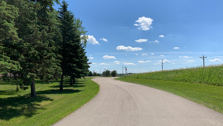
Roads are usually long resources that often present a complicated history. Researching the physical development and history for one road can be daunting task. Comparing the information on one road to other similar roads for larger regional and statewide contexts requires extensive research and large data sets on various topics – adding to the challenges. Geographical Information Systems (GIS) is an efficient and innovative tool for evaluating historic roads, and aids greatly in our review and analysis to keep transportation projects moving forward. As we’ve written before, we often use GIS in our work to analyze historic trends and themes through a visual analysis for historic roads in particular.
GIS in Action: Minnesota Trunk Highways
We saw the benefits of using GIS to research and apply the National Register Criteria for Evaluation of hundreds of Minnesota’s Trunk Highways for the Minnesota Department of Transportation (MnDOT).
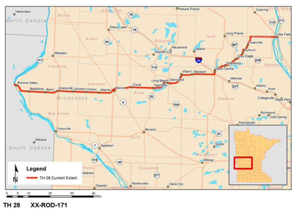
To assist with future planning, the MnDOT tasked our team with completing a study of the history of the state’s 213 historic-age Trunk Highways. We prepared a statewide historic context outlining the development of Minnesota’s Trunk Highways from their inception in 1921 to 1970. This work informed the development of a tailored methodology to apply the National Register Criteria for Evaluation specifically focused on identifying which highways are historically important. With so many highways across the state to consider, field survey and individual detailed highway research would have been extremely time consuming and costly.
To address this challenge, Mead & Hunt developed and applied a GIS-based screening process to assess roads and identify those with potential historic importance. This screening process served as a tool to more easily identify which roads had a potential association with historic themes, such as Entertainment/Recreation and Industry, and that warranted further work. The screening tool allowed us to identify and focus efforts on 39 of the 213 Trunk Highways that appeared to have associations with important themes and potential National Register eligibility. As important, this process allowed MnDOT to identify which roads did not possess significance and did not require further work.
After using GIS to screen Minnesota’s Trunk Highways, we continued to use GIS in our visual analysis while completing highway-specific evaluations and to assess the physical integrity to complete National Register eligibility recommendations for the individual Trunk Highways. The GIS-based methodology saved MnDOT time and cost by doing this work on all its Trunk Highways up front, rather on an individual case-by-case basis.
Key Takeaways
Pay it forward. We’ve developed best practices from our work for the MnDOT and on roads in many other states and use GIS whenever we evaluate historic roads. Our clients that need to address roads under Section 106 of the National Historic Preservation Act benefit from a tested process that saves time and money.
Share information. As an added benefit, this work was easily adapted for sharing information with the public. For example, after the project was completed, MnDOT developed a web-based statewide history, Minnesota’s Historic Trunk Highways, and a GIS-based storyboard, Historical Segments of Trunk Highways in Minnesota, which presents the history of the state’s trunk highways and highlights the roads found eligible in our project in an accessible and engaging manner.
Understand a complex resource. Our key takeaway is that using GIS greatly aids in understanding the histories of highways. While rarely straightforward, this tool streamlines an otherwise large or unwieldly process of completing National Register evaluations for long and complex properties. Thinking ahead, GIS provides an interactive and innovative way to visually convey this history by the agency to the public. GIS can even help develop mitigation when there are adverse effects to a National Register eligible road with online interpretive materials, such as these examples from MnDOT.
This post is part of our ongoing series sharing insights with you from our work on historic roads. Reach out and tell us what you think; we would love to hear from you.