
3D scanning technologies are becoming increasingly common in the AEC industry. At Mead & Hunt, we’re utilizing various scanning technologies to improve our project outcomes. The available 3D scanners and software tools range in price, accuracy, and versatility. We have found that both the higher cost and more affordable scan options have merits.
Affordable options
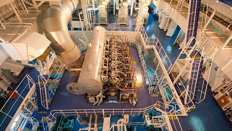
At the affordable end of the spectrum is a 3D camera called Matterport Pro2. As we’ve written about previously, this scanner is quick and easy to use and produces quality imaging with easy navigation. Within the imaging interface, users can take point-to-point measurements with a reasonable degree of accuracy. Matterport combines point cloud data with stitched together images to produce valuable general information about a site. For example, after two hours of scanning a 16-compressor, multistage engine room, we are now able to go back virtually to:
- Trace any line we want
- Verify piping and instrumentation diagrams (P&IDs)
- Grab snapshots from any angle for tie-in details
- Measure approximate distances (accurate within ~1 inch to 2 inches in typical engine rooms)
- Allow anyone to “walk through” the site who was not involved in the initial site visit
Matterport produces point cloud data, which is the collection of scanned three-dimensional points and their relative positions. Although the data can be used with a variety of software, the density of the cloud is insufficient for typical modeling purposes.
The ability to take measurements and virtually visit the project spaces has proven valuable in myriad ways. Virtual measurements can in many cases eliminate the need for scissor lifts and ladders that help to keep workers safe. And being able to take measurements remotely means that the site visits can be speedier and more productive. Our team has used Matterport to scan various projects to great success, including the Mead & Hunt Portland Office, various buildings at Davis-Monthan AFB, parts of the Durango-La Plata County Airport, and multiple Food & Beverage locations.
Higher-cost options
Laser scanners such as TruePoint or Leica ScanStation have both a higher cost and a higher degree of accuracy. These scanners typically provide resolutions of 1-4 millimeters per 10 meters, whereas the Matterport resolution is 15 millimeters. These more accurate scans can be utilized to model a project, using software that manages point cloud data. The accuracy of these measurements varies between scanners (typically 3 to 6 millimeters per 50 meters) but is significantly higher than the Matterport.
Point cloud data can be imported into Navisworks or Revit. With laser scans, this data is useful enough to produce models for project work.
The next level of modeling versatility comes from PointFuse, a software that converts point clouds into 3D mesh models and LOD 200 BIM models. This technology identifies different surfaces as meshes within the scan and allows the CAD operator to classify each separate mesh as a different type of equipment, pipe, vessel, wall, or floor. While the cost increases with added functionality, it can be well worth it, especially on complex jobs where accurate pipe take-offs and dimensioning can mean the difference between a smooth construction project, and a project with excessive change orders. Utilizing scanned data to produce models can also have a significant impact on the time spent modeling an existing space.
There are many factors to consider when investing in scanning equipment and modeling software, but the advantages of making an informed choice can be the difference between a successful project and a nightmare job.