Mead & Hunt has been providing engineering solutions for water infrastructure for 120 years. Since the beginning, we’ve engineered solutions to procure and keep water in watershed reservoirs. Now, in response to sea level rise (SLR) caused by climate change, we find ourselves addressing the challenge in reverse—rather than trying to keep water in, we must keep rising tides at bay for coastal clients nationwide.
SLR (and the associated flood risks) is just one of many issues we face in response to global climate change. Combating these issues requires a more wholistic planning framework, one that encompasses short- and long-term solutions and accounts for multiple interacting variables. Simply addressing individual problems as they occur is not enough to overcome the complex, intersecting challenges that come with global climate change.
We at Mead & Hunt understand this. Our climate adaptation strategies combine flexible adaptation design solutions for the near- to mid-term while also monitoring for infrastructure resiliency for the long-term. As part of asset protection, our adaptive design works to facilitate upgrades in the future. This offers improved protection without having to rebuild the infrastructure from scratch.
Climate change adaptation planning framework in action
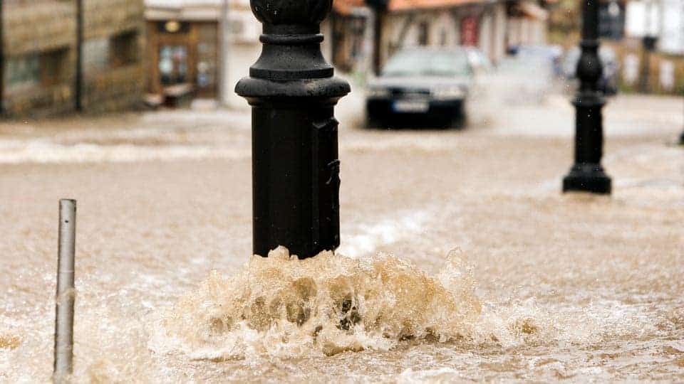
I recently worked on an asset protection project to reduce potential flood damage to critical facilities infrastructure. The project site is in a highly urbanized coastal zone in the San Francisco Bay Area where heavy rainfall often exceeds the capacity of local storm drains and natural drainageways that carry floodwater to the Bay. Extreme tides make conditions worse, often causing property damage and encumbering essential services as floodwaters back up into city streets. It’s projected that as seas rise there could be a greater recurrence of flooding.
As part of their investment decision-making, our client needed a climate-resilient infrastructure design to reduce potential flood risk over the next 80 years and to extend the life cycle of the infrastructure. Our team developed a framework for climate change adaptation planning to assess future vulnerabilities specific to this site. We incorporated information from a mosaic of state and local guidance documents and tools to do so:
- California Office of Planning and Research’s Planning and Investing for a Resilient California Guidebook (2017)
- California Ocean Protection Council’s (OPC) Sea-Level Rise (SLR) Guidance Document (2018)
- San Francisco Bay Conservation and Development Commission’s Adapting to Rising Tides Program
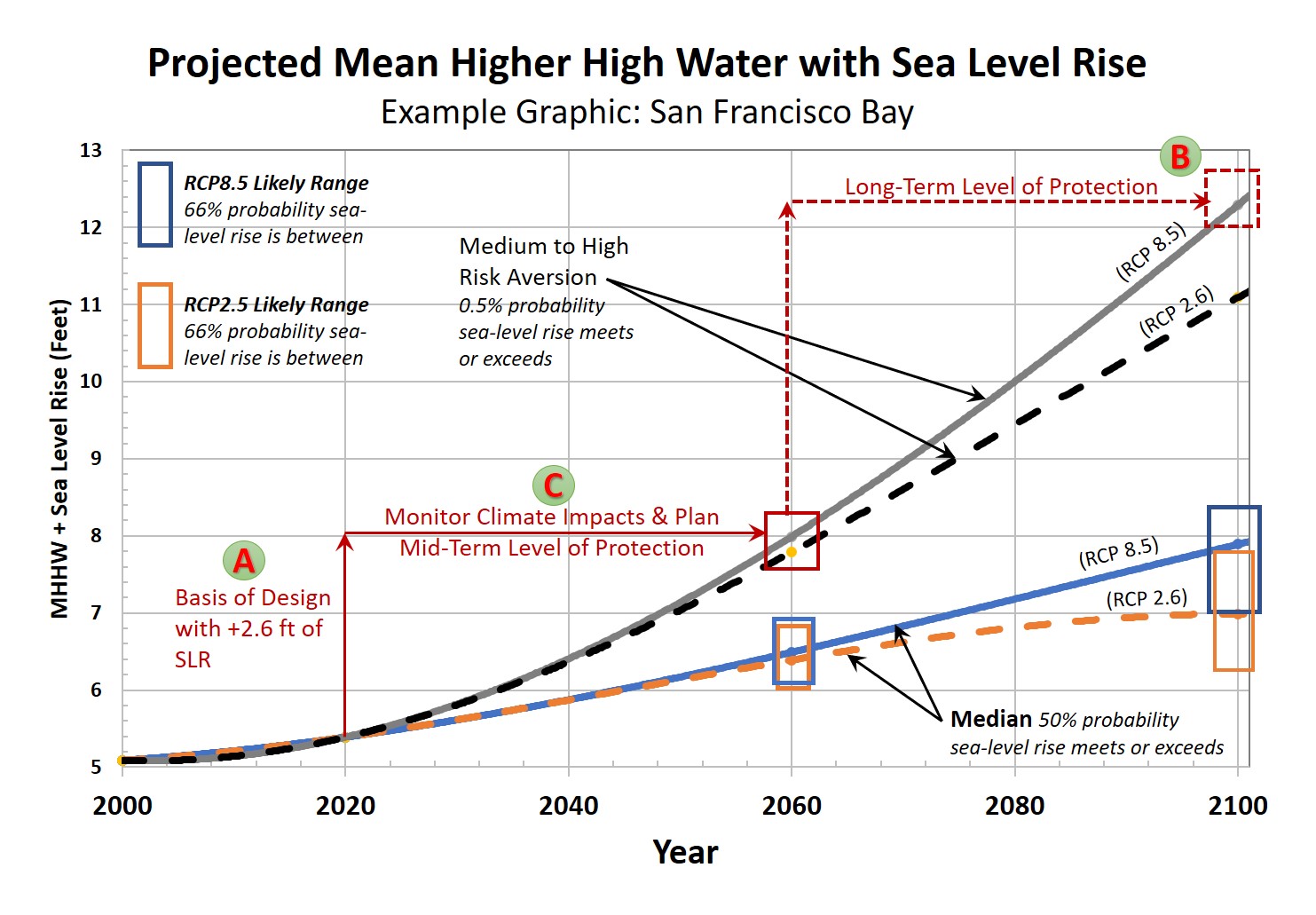
To develop our design recommendations related to SLR, we drew from the climate change Observational Method (OM) introduced in ASCE’s Climate-Resilient Infrastructure, Adaptive Design and Risk Management. Figure 1 below illustrates the climate change projections reported in OPC SLR Guidance. Using the OM, we established our mid- and long-term goals for Final Engineering Design (steps are shown in red on Figure 1):
A. Design to the most likely outcome using Mean Higher High Water (MHHW), plus 2.6 feet of SLR
B. Incorporate adaptation design solutions to plan for the most probable outcome for 2100
C. Monitor changes and SLR science, revaluate prior to 2060 to determine the requirements to mitigate risks to 2100
Based on our findings, we recommended managing climate change risks using pumps, gates, and low-cost barriers. As we complete final design and move toward a “shovel-ready” project, we’re also evaluating grant opportunities to expedite project implementation.
The climate change and adaptation planning framework we developed for this project is scalable locally and could be replicated in other coastal areas. As part of our climate initiative, we look forward to developing similar climate change adaptation strategies for coastal clients throughout the nation, looking for climate-resilient infrastructure solutions to address current and future risks.